
East and south · Hurghada local dive sites
Hurghada East and South Dive Sites Fifteen reefs around Giftun and Abu Ramada
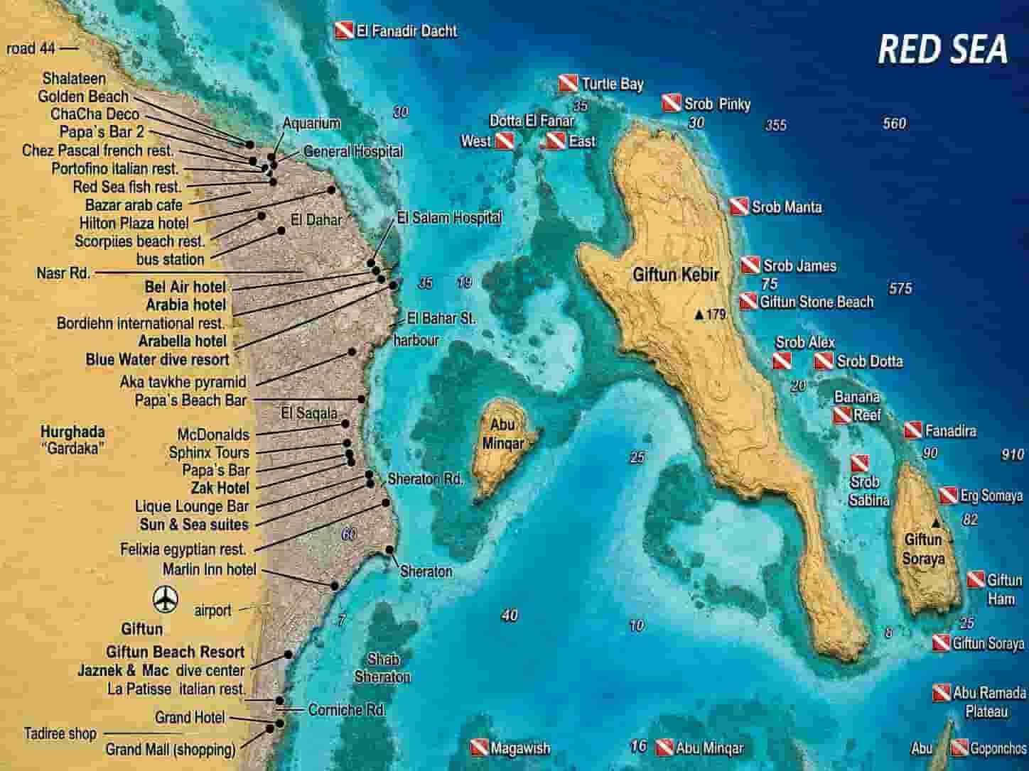
South of the marina the diving changes character. Instead of the exposed offshore pinnacles of the north, you get islands, straits and sheltered lagoons, and consequently a far higher proportion of days when the boat can actually go where it planned to. Fifteen Hurghada local dive sites sit within ninety minutes, and several of them are workable in weather that would cancel everything further out.
How the Hurghada local dive sites are arranged
Two big islands dominate these Hurghada local dive sites. Specifically, Big Giftun and Small Giftun sit side by side with a strait between them, and that strait is the single most useful thing about the area: it gives shelter on one side or the other in almost any wind. Meanwhile the Abu Ramada group lies further east and takes the weather more honestly.
The bottleneck shape of the strait has a second effect, however. Tide funnelling through a narrow gap builds current, sometimes considerable current, which is why several of these sites are drifts by nature rather than by choice. Consequently, checking the direction before anyone gets wet matters as much here as anywhere.
Depth is the other axis. Generally, this area is shallow, between five and twenty metres, which makes it excellent for training and for long relaxed dives. Nevertheless a handful of sites drop hard: Erg Somaya runs past sixty metres and North Abu Ramada falls beyond a hundred, so those two need people who know what they are doing.
Reading the day
- First, wind decides which side of the strait you dive, not whether you dive
- Then the tide decides how hard the current runs through the gap
- Also, the Magawish sites stay workable when almost nothing else does
- Meanwhile Abu Ramada is the exposed end and needs a settled forecast
- Consequently the shallow ergs suit training and the deep walls do not
- Finally, macro life here rewards slowing down far more than covering ground
Stonefish are genuinely common. Notably, several of these descriptions mention them without ceremony, and one site is described as somewhere you would be unlucky not to find one. Above all, look before you put a hand down anywhere.
Jump to a reef
Hurghada local dive sites at Magawish
Altogether, forty-five minutes out and tucked behind the Magawish islands, these two are a short trip. Above all they are reliable: choppy on a windy day, certainly, but rarely cancelled.
Shaab Eshta
27°09.00′ N · 33°53.66′ E · 7–12 m · 45 min
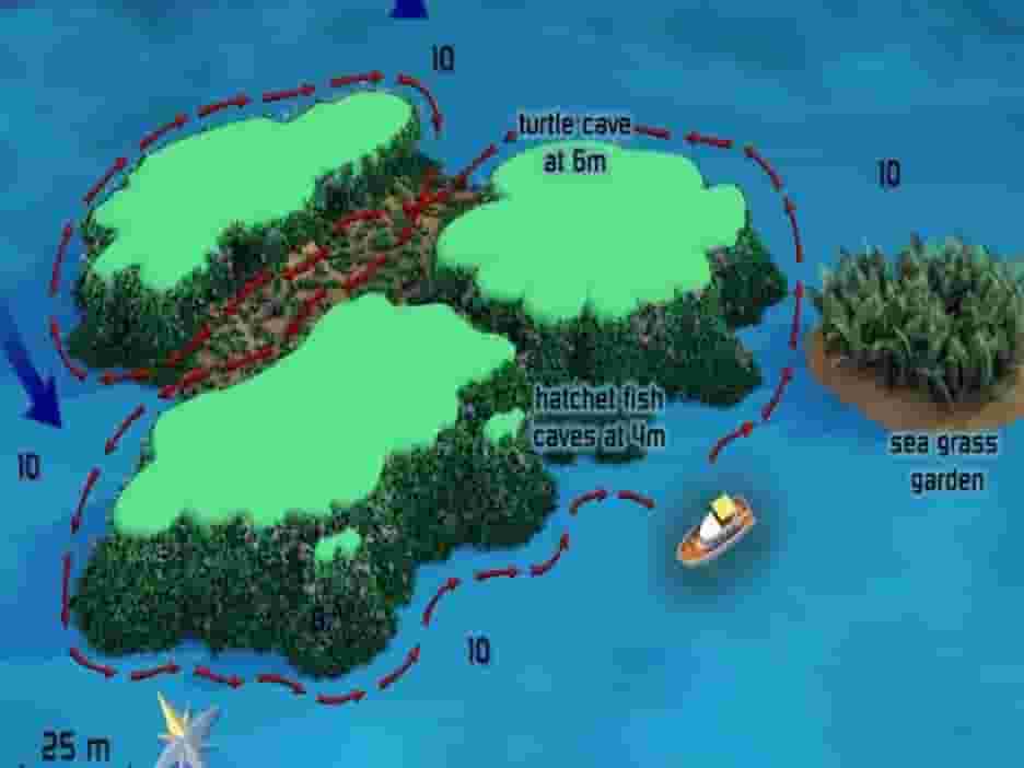
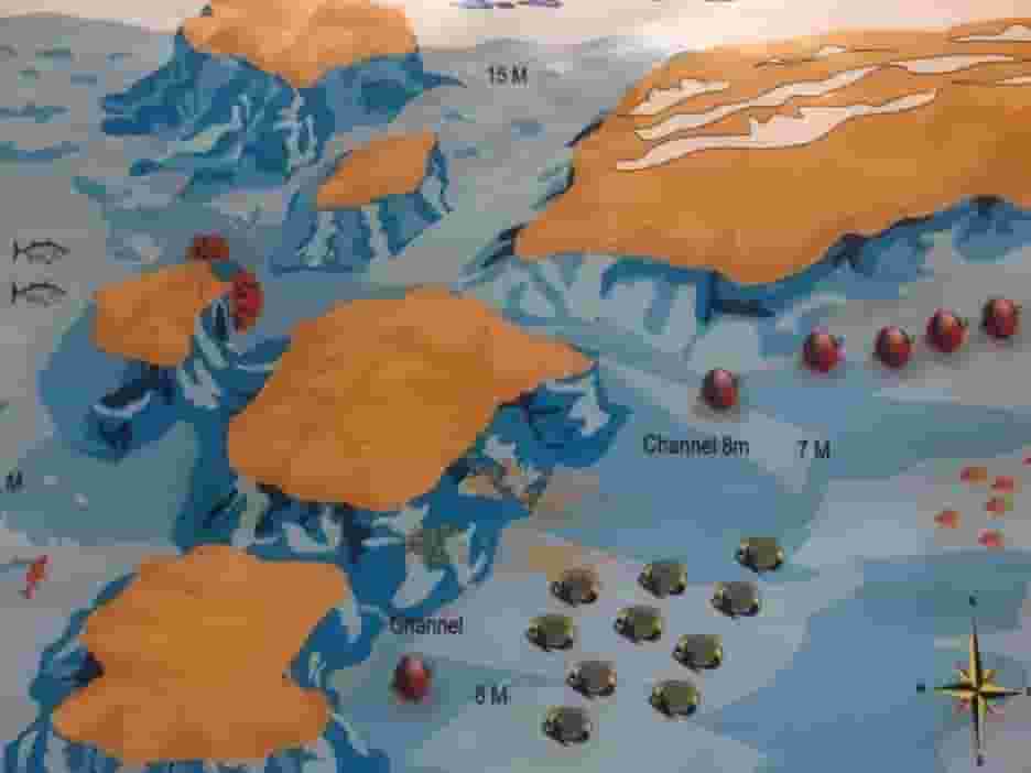
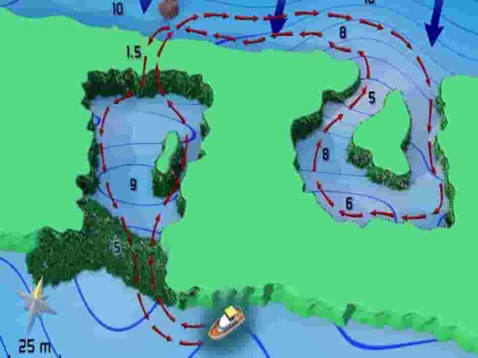
Firstly, two ergs sit divided by a narrow channel. Specifically, the smaller lies to the west, while the larger, to the east, is shaped like a heart and has a tight canyon-like passage running up to its top. Because the site is shallow and protected, it is one of the better places on this coast to put a first-time diver in the water.
Out at the edges, swaying sea grass covers a good portion of the bottom, while closer in the sandy flats carry small coral blocks and table corals. Some current funnels through the channel as the tide moves, although it is not usually strong enough to cause trouble. Consequently a figure-of-eight route works beautifully here.
Watch for
- Notably, barracuda hover just below the surface in the channel, waiting
- Then scorpionfish, parrotfish, butterflyfish and angelfish on both ergs
- Also sweetlips, goatfish and bannerfish concentrated beside the reef walls
- Finally, gobies and their shrimps out on the sand
Shaab Petra
27°09.02′ N · 33°53.42′ E · 8–15 m · 45 min
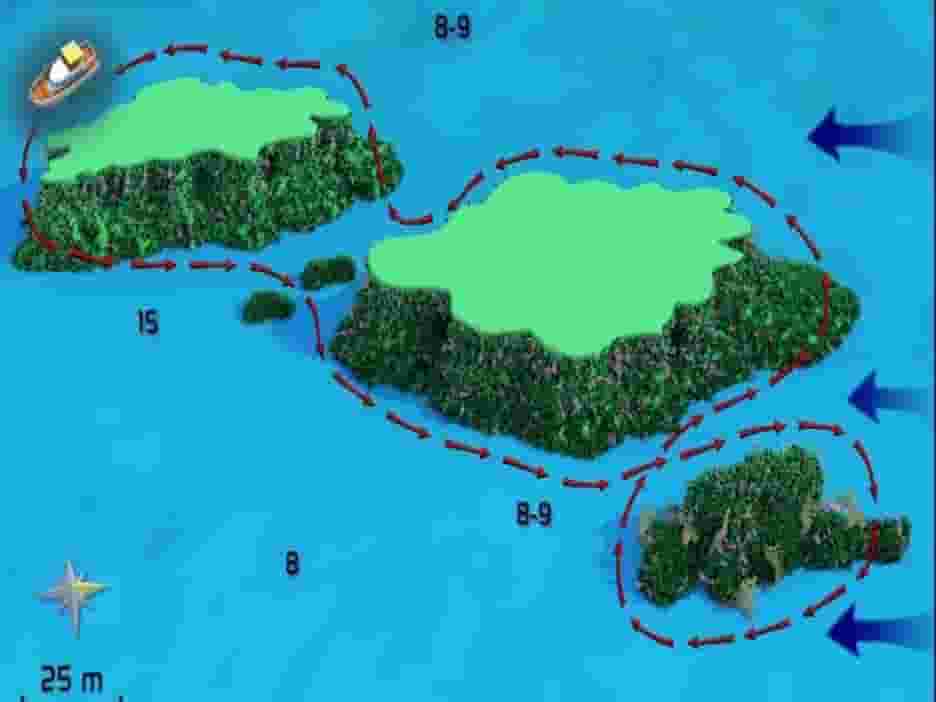
Similarly, its neighbour offers two oval ergs separated by a coral garden some sixty metres long, running east to west. Mooring lines sit on the south side of each erg, so you can start on either. Notably, both are hill-shaped, and the hard coral in the shallows is in truly excellent condition.
Then, at the end of the eastern erg, pointing towards the coral garden, an enormous brain coral sits looking uncannily like a resting turtle. On its other side a small cavern holds a group of glassfish and a grouper who spends his time chasing lionfish away from his food supply. Meanwhile the western erg is smoother and sits on flat sand. Consequently a figure-of-eight here takes about forty-five unhurried minutes.
Watch for
- Firstly, bicolour and bluegreen pullers, Arabian damsels and humbug damsels
- Also endless schools of sergeant major and goatfish over the top
- Then free-swimming moray eels through the coral garden, which is common here
Hurghada local dive sites around Big Giftun
Altogether, between an hour and seventy-five minutes out, these three sit against Big Giftun and Small Giftun. Notably, they cover the full range: one is a beginner’s playground of pinnacles, one is a wall that falls to fifty metres, and one goes past sixty.
El Erug
27°10.00′ N · 33°57.05′ E · 12–14 m · 60 min
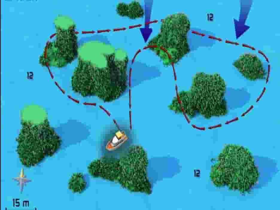
Firstly, ergs and pinnacles lie scattered across a wide area north of Gota Abu Ramada. Though people generally treat this as one dive site, it is really three. From the southwest they run Erug Diana, then Erug Giftun in the middle, and finally Erug Gigi to the northeast.
Specifically, Erug Giftun is a cluster of seven pinnacles, as is Erug Diana, except that its middle one is cracked in two. Meanwhile Erug Gigi has eleven, more or less in a line. Because there are so many of them, losing your sense of direction is easy; without a compass, take your bearings from the current or the angle of the sun, or simply stay with two or three ergs and do not wander.
Frankly there is no reason to wander anyway. Naturally, one part is as good as another, and since the tops of the ergs are the prettiest, the safety stop often turns out to be the best of the dive.
Watch for
- Namely, moray eels of several kinds: yellowmouth, giant, snowflake and peppered
- Also Napoleon wrasse working between the pinnacles
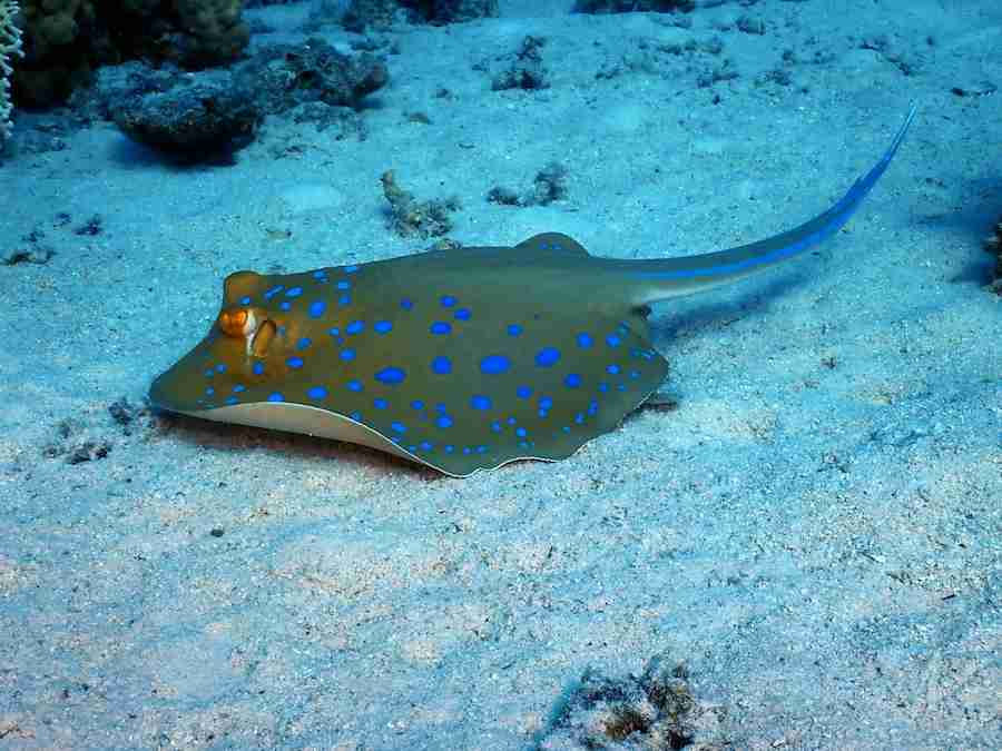
- Then bluespotted rays, crocodilefish and scorpionfish down on the sand
Hamada Reef
27°14.25′ N · 33°55.73′ E · 0–15 m, sloping past 50 m · 70 min
Also known as Stone Beach, and as Lion’s Head. Usefully, a small bend in Big Giftun gives it some protection from the wind. From the top of the reef a tiny wall runs down to twelve or fifteen metres, becomes a slope, and then breaks into a stepped drop from thirty-five to beyond fifty. Then, to north and south alike, that slope turns vertical.
Generally, drifting from the north is the popular choice. Notably, the sheer wall gets better as it goes, interrupted by coral formations, and towers reaching out with caverns and swim-throughs under a coat of soft coral. Afterwards you can finish shallower over the slanting coral garden.
Alternatively, start from the mooring and work the coral garden properly, including its deeper half. Certainly the hard coral here is in excellent condition, and almost directly under the boat sits a gigantic green lettuce coral at around thirty metres. Swim a wide anticlockwise circle and you will arrive back in the shallows exactly when it is time to turn.
Watch for
- Firstly, snapper, surgeonfish and goatfish in schools across the shallows
- Then Napoleon wrasse, groupers and morays deeper down
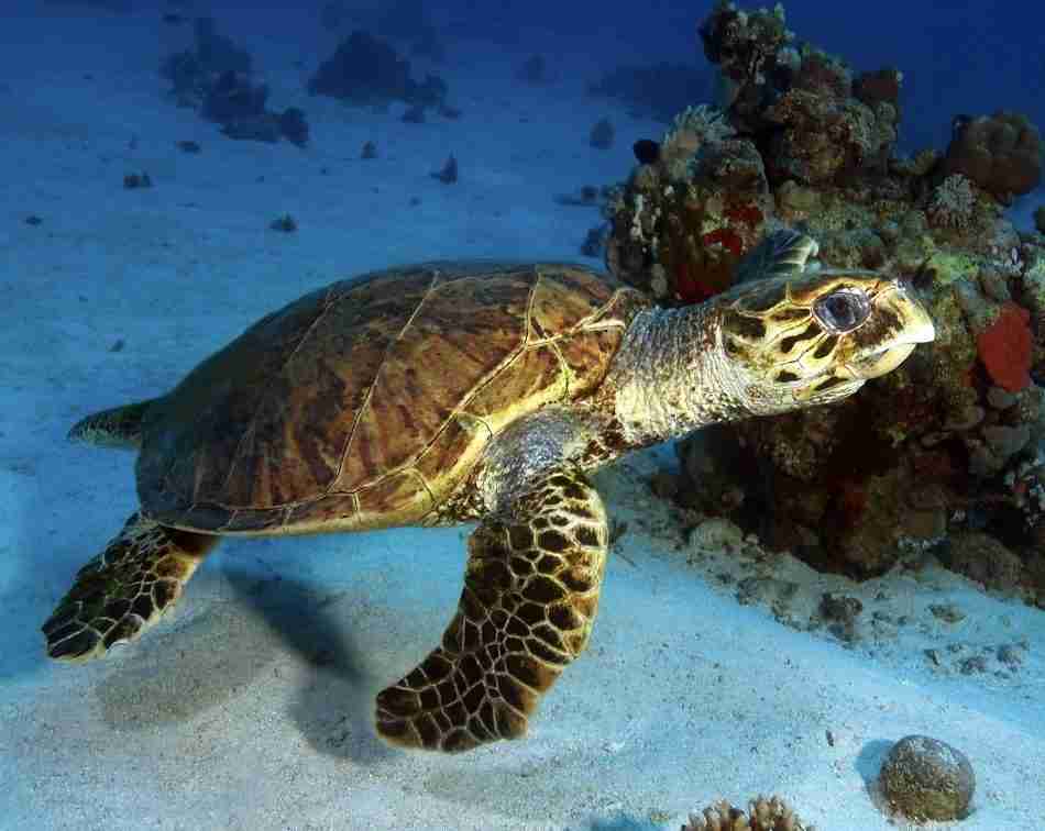
- Also turtles, and sharks, both of which pass through from time to time
- Whale sharks and mantas, which have been sighted here, though rarely
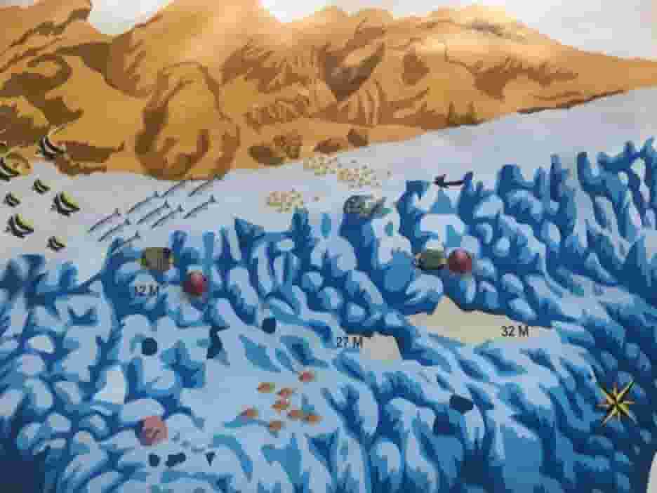
Erg Somaya, one of the deepest Hurghada local dive sites
27°11.93′ N · 33°58.97′ E · 5–60 m and beyond · 75 min
Firstly, just north of the police station on Small Giftun, the vertical wall gives way to a shelf carrying an erg that reaches to within five metres of the surface. Further north again, the shelf yields to a steeply sloping wall with two sculptured coral formations on it. Because the site sits on the exposed east side, the weather has a say, and the deeper sections need experience.
Mooring or drift both work equally well. Specifically, north of the shelf the steep wall is broken by a series of coral towers reaching out into the blue, covered in soft coral and gorgonians and almost absurdly photogenic. Meanwhile the shelf around the erg is sloping sand with a chimney at its northeastern corner: enter at thirty metres and exit at twenty-two.
The erg itself starts at five metres and lands between nine and fifteen, which makes it a near-perfect safety stop rather than an afterthought.
Watch for
- Firstly, barracuda, snapper, jackfish and tuna working the wall
- Then clouds of anthias and silversides breaking off the coral towers
- Also butterflyfish, seemingly every species that exists
- Finally, glassfish overflowing the chimney, and invertebrates all over the erg
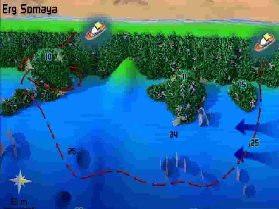
Hurghada local dive sites at Abu Ramada
Eighty minutes out, the Hurghada local dive sites change character again. All three sites here are exposed to weather and current, yet that same current is exactly what keeps them in the condition they are in.
North Abu Ramada, deepest of the Hurghada local dive sites
27°10.41′ N · 33°59.07′ E · 20–35 m, drop-off past 100 m · 80 min
Firstly, a plateau sloping gently from twenty to thirty-five metres runs off the north end of Abu Ramada Island before turning vertical. Usually, moorings sit inside a small bend in that wall. Experience beyond entry level is required for the deep plateau, and the site is often exposed to both weather and hard current.
Ideally, provided the current comes from the north, dive it as a drift. Drop in front of the end of the reef and work out towards the drop-off; the strength and direction will then tell you how to continue. From there you can follow the plateau edge north for a few minutes, or head straight back towards the mooring. Notably, beneath the edge there is a chimney running from thirty to twenty-four metres, right where the plateau becomes wall. Multilevel up from there and spend the end of the dive where sunlight comes through the cracks in the top reef.
Watch for
- Firstly, giant barracuda schooling against bigeye trevally and yellowfin tuna
- Then fusiliers sweeping the plateau, which is what they are all fighting over
- Also eagle rays, in squadrons of up to twelve, flying past in formation
- Meanwhile lionfish and groupers stake out glassfish in the cavities
- Sharks out in the deeper water, so keep looking into the blue
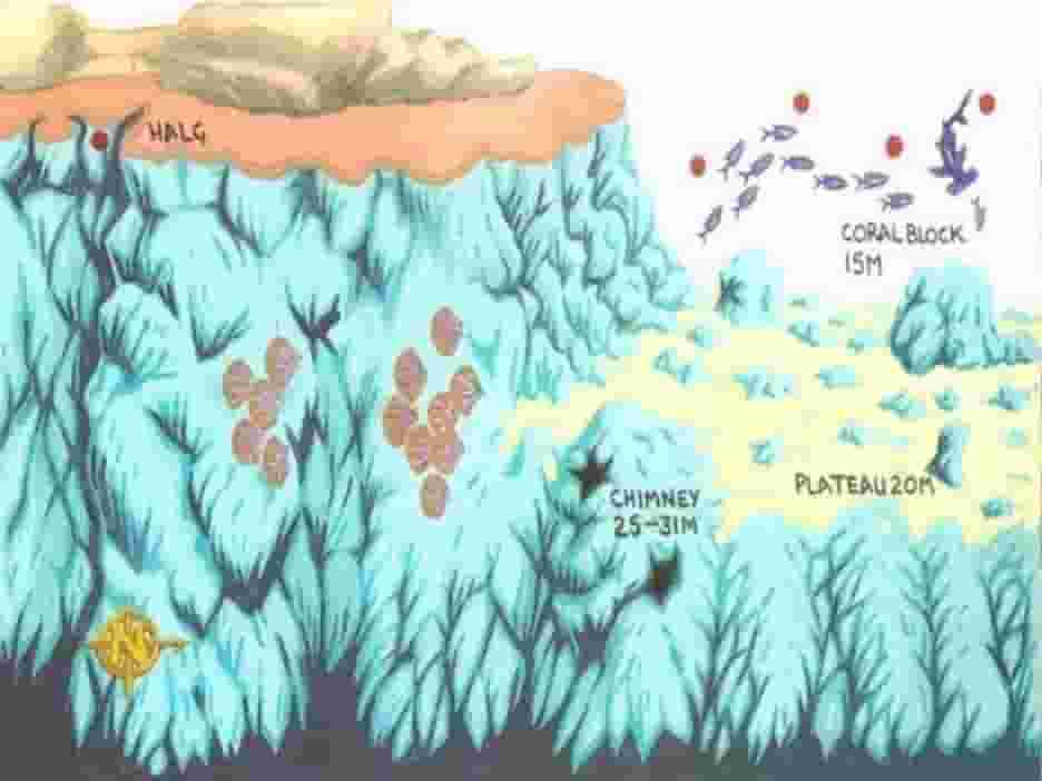
Erg Abu Ramada
27°9.78′ N · 33°59.04′ E · 10–30 m, terracing past 60 m · 80 min
Camel Reef, as it is also known. Firstly, a big erg with three peaks stands on a long plateau, with a sandy bottom turning into coral garden to the north, off the southeast side of Abu Ramada Island. Frankly, depending on the current, this site is either heaven or hell, and there is not much middle ground.
Ideally, on a good day with the current negligible, start from the mooring and go out to the coral garden, which slopes away both east and west and holds a remarkable amount of life. Then turn back and finish among the three peaks of the erg itself, where the safety stop is spectacular and the camera angles are everywhere.
Certainly the current is why it is beautiful. Between the flow and the unprotected position, this reef gets dived far less than the sheltered ones, and it has stayed pristine as a direct result.
Watch for
- Notably, soft coral and anthias covering the erg completely
- Then great schools of glassfish sheltering in the caverns and cracks
- Also the scorpionfish and lionfish waiting for them, which is the whole point
- Finally, crocodilefish under the table corals, and morays circling the peaks
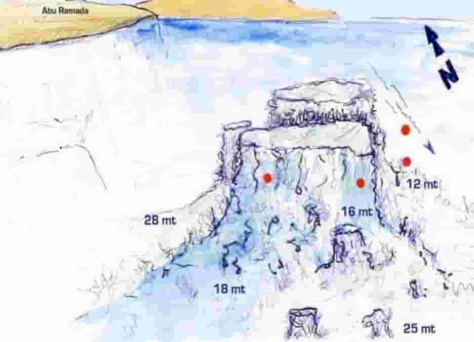
South Abu Ramada
27°9.51′ N · 33°58.74′ E · 5–35 m · 80 min
Notably, this is the exception in the group, and the busy one. Specifically, a terraced plateau sits beside a shallow wall at the very southern tip of Abu Ramada Island, extending west as a shelf before yielding to a drop-off. Because it is sheltered whatever the weather does, it fills up on windy days.
Then that shelf slopes from eleven metres at the foot of the wall out to the drop-off at around fourteen, and halfway across it you find an eel garden swaying in the current. Further south, a hill-shaped coral formation clings to the very edge of the drop-off, and just east of that a run of pinnacles leads back towards the mooring lines.
Finally, the wreck of an old safari boat lies on a raised coral garden right beside the top of the reef at five metres. Consequently the safety stop here is rather better than most.
Watch for
- Macro life on the bottom, which looks empty until you actually look
- Then masked butterflyfish, bannerfish, goatfish and sweetlips in mass
- Also free-swimming morays cruising the wall
- Certainly Napoleon wrasse, which come close enough here to inspect you properly
Hurghada local dive sites inside the strait
Altogether, ninety minutes out, in the channel dividing Big Giftun from Small Giftun. All four of these sit behind the reef and are sheltered from the wind, yet the strait itself concentrates the tide, so strong current is a real possibility on any of them.
Turft El Shahid
27°11.22′ N · 33°57.84′ E · 8–20 m · 90 min
Generally, people describe this one as being between the mountains, and the phrase fits. You will also see the name written Turft El Shahed, and on some charts as Torfa Shaheed. Specifically, right in the middle of the Giftun Marine Park, where the channel splits the two islands, an extension of Small Giftun’s northern tip lies encircled by pinnacles.
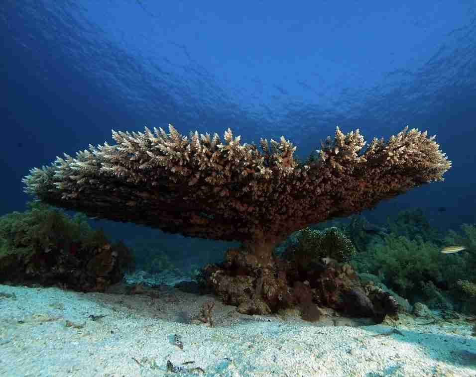
First, from the mooring a shallow channel runs west to those pinnacles, which are the reason to come. Meanwhile, northwest of the channel the bottom is mostly flat sand with coral blocks scattered at random across it. Then carry on north and you reach a beautiful erg riddled with cavities and overhangs.
Closer to the mooring, on the south side of the main reef, the coral is frankly not in good condition. Nevertheless a stonefish encounter makes the safety stop worth having. Alternatively you can drift the whole way to neighbouring Banana Reef, although that asks for good gas consumption and better navigation.
Watch for
- Firstly, soft coral covering the pinnacles, and gobies with their shrimps on the sand
- Then crocodilefish lurking under table corals alongside Moses sole
- Also eagle rays, which are quite common here, and feather-tailed rays
- Turtles feeding in the soft coral, so keep glancing into the blue
Banana Reef, most photogenic of the Hurghada local dive sites
27°13.16′ N · 33°57.04′ E · 14–22 m · 90 min
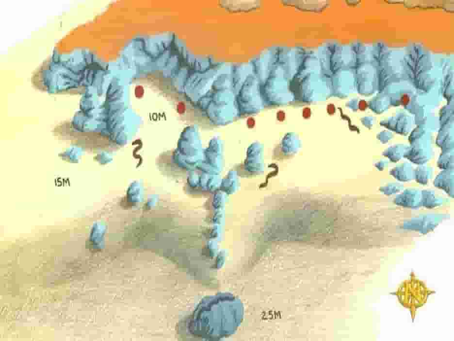
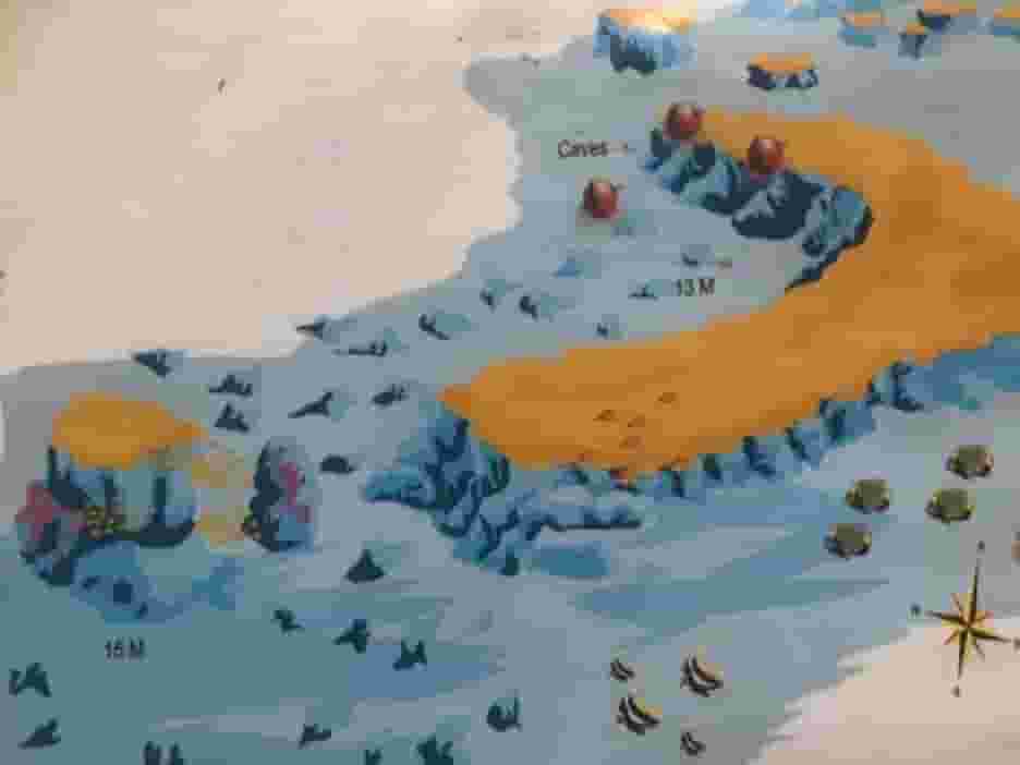
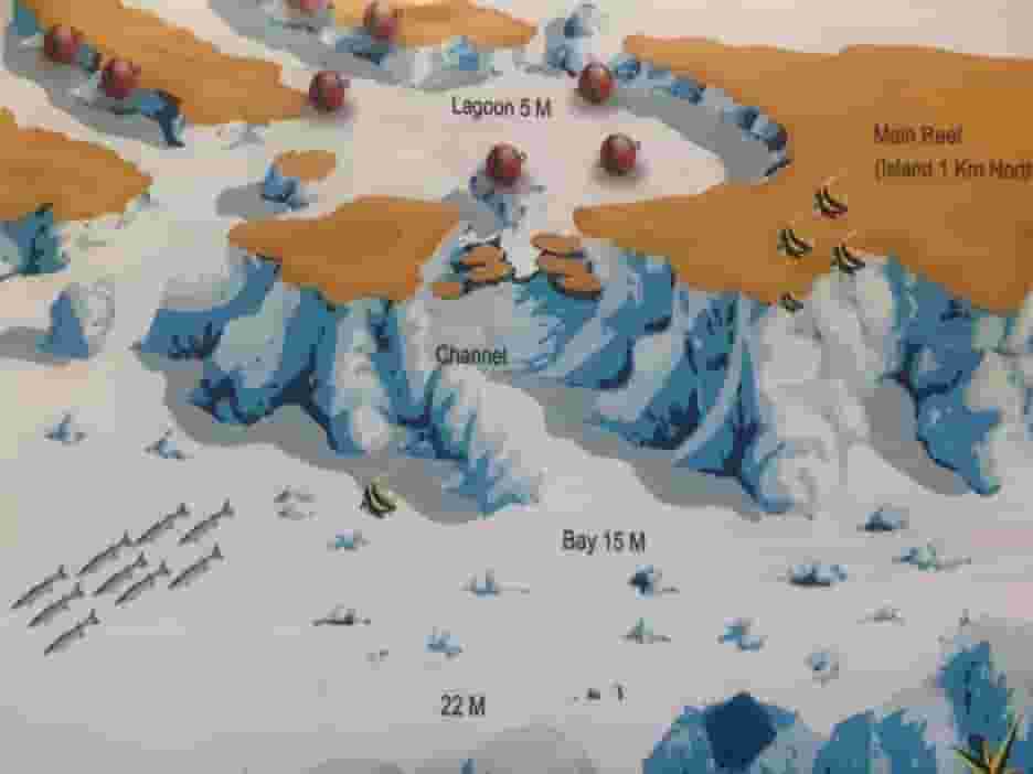
Firstly, moorings sit on the south side of a crescent-shaped main reef that encloses a coral garden and two gorgeous pinnacles; the shape is where the name comes from. Because the tide funnels through this area and can build serious current, drifting is the natural way to dive it.
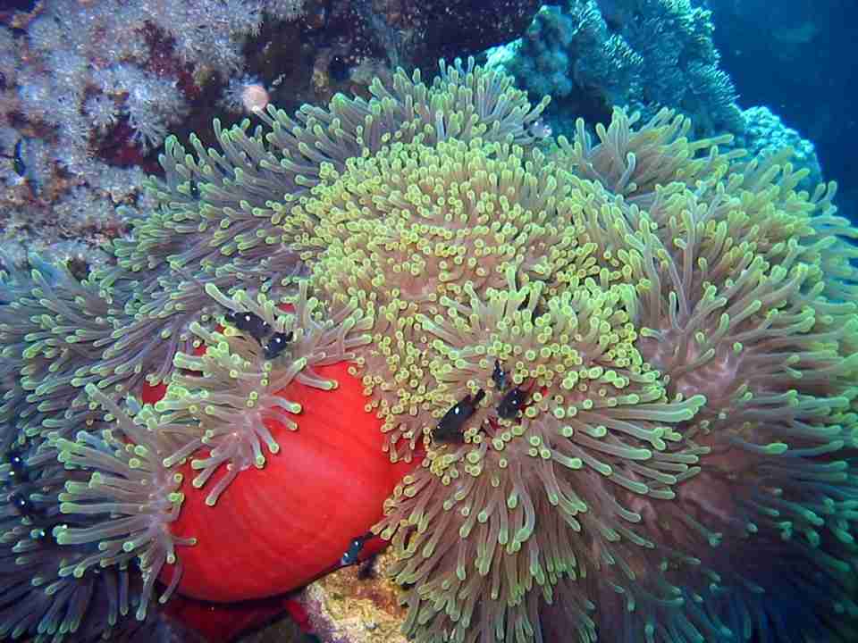
The wall of the main reef is not the best part, though it is useful to keep in visual range for navigation. Instead, the coral garden slopes northwest and becomes sandy seabed at twenty-two metres. Then, in the southeast corner, close to the wall at fourteen metres, sits an anemone city. Meanwhile, straight out from the southwestern end, two pinnacles smothered in soft coral rise towards the surface from fourteen to seventeen metres.
Certainly the most photogenic site in the area. Between the anemone city, the pinnacles and the light over the coral garden, this is the one people come back with pictures from.
Watch for
- Firstly, eagle rays and feather-tailed rays crossing the coral garden regularly
- Then hundreds of anemonefish guarding juveniles in the anemone city
- Also soft corals and gorgonians smothering both pinnacles
- Finally, jackfish, barracuda, groupers and lionfish hunting the silversides and glassfish
Shaab Sabina
27°12.98′ N · 33°57.26′ E · 8–14 m · 90 min
Firstly, boats moor on the south side of a tongue of reef running east. Then, north of the main reef, a maze of ridges and ergs spreads out into genuinely dramatic underwater landscape, with an exquisite coral garden to the northwest. Training works well here, provided everyone understands that strong current is possible.
Naturally, dive it as a drift. First you drop onto the coral garden as it cascades down from the top of the reef towards the seabed at fourteen metres, and below that a labyrinth of coral formations catches the light coming through the waves and throws it across bright white sand patches. Frankly it is a spectacular thing to swim through.
Then, south of the maze, the main reef wall slopes up from eight or ten metres towards the surface, hard coral growing on top of hard coral like a Japanese garden. Typically the nutrient-rich water has made the north face sparkle while the south side is effectively dead, which is a useful lesson in where to spend your time.
Watch for
- Above all, the landscape itself, which is the main reason people dive here
- Then hard coral in quantity, which photographers rarely get past quickly
- Also big porcupinefish and giant pufferfish resting out on the sand
- Finally, rays of several kinds, and stonefish, which you would be unlucky to miss
Erg Sabina
27°12.97′ N · 33°57.25′ E · 10–12 m · 90 min
Firstly, a small reef rises off flat sand at ten to twelve metres, with coral blocks and table corals around it, moored on the south side. Shelter is not complete here, and the bottleneck shape of the strait can produce strong current.
Small though it is, the marine life makes this an extraordinary dive rather than a filler. The erg is best on its north face by nature, so concentrate there. Then, beside the reef, stand a few big brain corals with schooling fish hanging over them facing into the current. Then, about fifty metres north, there is a breathtaking little erg full of soft coral and glassfish and excellent camera angles. Take your time getting there and back, looking under every table coral and block on the way, and the dive repays it.
Watch for
- Firstly, turtles, eagle rays, feather-tailed rays and Napoleon wrasse, as everywhere here
- Then glassfish and silversides in volume, which is what draws the hunters
- Also jackfish, lionfish, scorpionfish and groupers working those clouds
- Finally, crocodilefish camouflaged on the sand, hunting from below
Further south
Ninety minutes again, but in the other direction: two sites well south of the islands, both sheltered, both easy, and both quite different from the strait.
Ras Disha
27°02.47′ N · 33°53.40′ E · 9–18 m, with a drop-off · 90 min
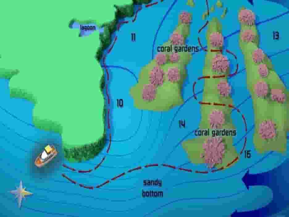
Firstly, a shallow plateau of sand is punctuated by pinnacles, with an oval erg at its southern end. To the northwest the plateau narrows into a ledge and then gives way to a steep wall. The bay shelters it from wind, although current can still run hard.
Usually, the beacon on the main reef gives an obvious landmark for a drift north along the wall, finishing among the pinnacles out on the plateau. Alternatively, from the mooring you can run out to the drop-off first, then swing a half-circle back over the plateau past the pinnacles to the boat. One in particular, the pinnacle closest to the main reef, is exceptionally photogenic.
Watch for
- Firstly, bannerfish and butterflyfish with parrotfish and surgeonfish near the wall
- Then Moses sole, bluespotted rays and torpedo rays digging the sand
- Also partner gobies and shrimps watching from their burrows
- Finally, glassfish bursting out of the cracks and caverns in the pinnacles
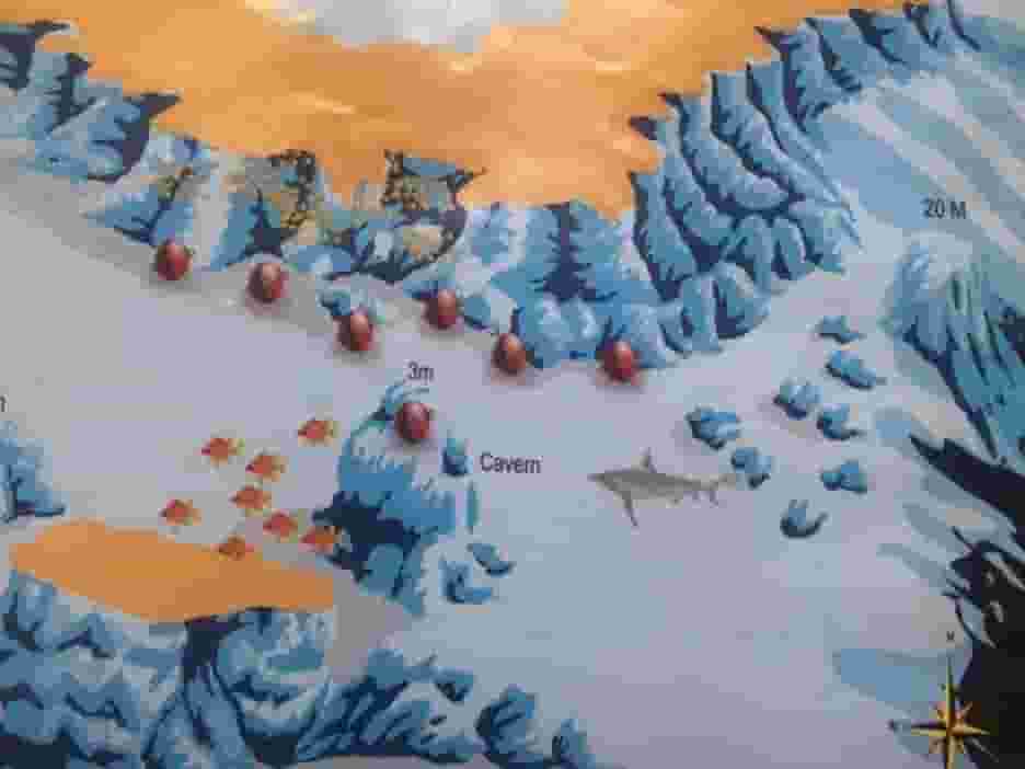
Abu Hashish
27°00.74′ N · 33°55.44′ E · 6–25 m beside a drop-off past 60 m · 90 min
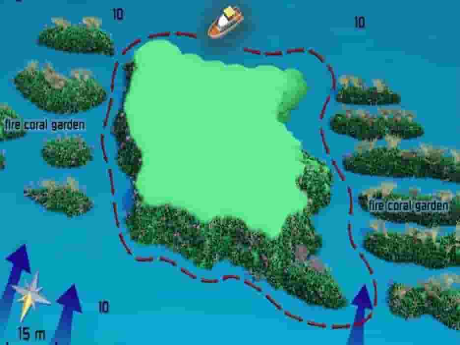
Firstly, Abu Hashish Island sits inside an extensive reef on a flat sandy plateau that runs out to a steep drop-off. Then, at the southern end, a shallow lagoon scattered with ergs shelters the moorings. Crossing can be choppy in wind; once you arrive, however, it rarely matters.
Certainly several good dives are possible here. The usual one runs from the mooring through a narrow channel in the reef, out to the drop-off, then back along the wall. Meanwhile the lagoon itself holds numerous ergs and pinnacles in thoroughly protected water, which is why courses end up here so often. A drift from the north also works, with a quick look at the drop-off and then multilevelling towards the safety stop before entering the lagoon.
About the name. Local accounts say it comes from the contraband that once passed through here, which is either true or a very good story.
Watch for
- Firstly, cornetfish in the lagoon, and bigfin reef squid hovering in formation
- Then hooded cuttlefish crossing the bottom, changing colour and texture as they go
- Also a big red octopus out on the wall, relying entirely on camouflage
North of Big Giftun: the closest reef of all
Finally, one site that sits apart from the rest. Namely, Turtle Bay lies well north of everything else on this page, closer to the Fanous reefs than to Giftun, and it is the shortest crossing here by some margin.
Turtle Bay
27°15.75′ N · 33°53.10′ E · 2–15 m · 30–45 min
A small horseshoe reef on the south side of Shaab El Fanous, north of Big Giftun, running from two metres to fifteen. Nothing about it is complicated. Frankly it is simply full: fish and coral everywhere, in water shallow enough that the light stays bright the whole dive. Divers who have been describe it as swimming in an aquarium, and that is about right.
Right beside Fanous. The position above sits about six hundred metres southwest of Fanous East, which is exactly what you would expect of a reef described as adjacent to it. Consequently the two are often dived on the same trip, and Fanous East is covered on the northern page.
Choosing between the Hurghada local dive sites
In short, the table below sorts all fifteen by travel time, because that and the forecast are what actually decide the day. The number in the first column matches the index above.
| # | Site | Out | Depth | Level |
|---|---|---|---|---|
| 15 | Turtle Bay | 30–45 min | 2–15 m | All levels |
| 1 | Shaab Eshta | 45 min | 7–12 m | All levels |
| 2 | Shaab Petra | 45 min | 8–15 m | All levels |
| 3 | El Erug | 60 min | 12–14 m | All levels |
| 4 | Hamada Reef | 70 min | 0–50 m | All levels |
| 5 | Erg Somaya | 75 min | 5–60 m | Experienced |
| 6 | North Abu Ramada | 80 min | 20–35 m | Experienced |
| 7 | Erg Abu Ramada | 80 min | 10–30 m | Some experience |
| 8 | South Abu Ramada | 80 min | 5–35 m | All levels |
| 9 | Turft El Shahid | 90 min | 8–20 m | All levels |
| 10 | Banana Reef | 90 min | 14–22 m | Most levels |
| 11 | Shaab Sabina | 90 min | 8–14 m | All levels |
| 12 | Erg Sabina | 90 min | 10–12 m | Most levels |
| 13 | Ras Disha | 90 min | 9–18 m | All levels |
| 14 | Abu Hashish | 90 min | 6–25 m | All levels |
Marine life around Giftun and Abu Ramada
Rays
Notably, eagle rays are common in the strait, sometimes twelve at a time at North Abu Ramada. Feather-tailed and torpedo rays too.
On the sand
Namely, crocodilefish, Moses sole and bluespotted rays, with partner gobies and their shrimps at every burrow.
Cephalopods
Abu Hashish in particular: bigfin reef squid, hooded cuttlefish and a resident red octopus out on the wall.
Clouds and hunters
Meanwhile glassfish and silversides fill every cavity, and jackfish, lionfish and groupers spend their days working through them.
Big animals
Namely, turtles throughout, sharks off the deeper walls, and at Hamada Reef the occasional whale shark or manta.
Hazards
Stonefish and scorpionfish are common everywhere here, so look carefully before you steady yourself on anything.
Planning a day on the Hurghada local dive sites
Practical notes
- Pick the side of the strait that suits the wind, rather than a fixed plan
- Then check the current before anyone enters, since the strait concentrates it
- Also treat Erg Somaya and North Abu Ramada as deep dives, because they are
- Meanwhile the shallow ergs at Magawish are the sensible choice for training
- Also, carry an SMB on the drifts, which is most of the strait sites
- Consequently a torch pays for itself in the chimneys and caverns
- Finally, slow down: this area rewards looking closely far more than covering ground
The sheltered ones get busy. South Abu Ramada is always diveable and consequently crowded on windy days. If you want it quiet, go when the forecast is good and everyone else has gone further out.
Useful links
- Hurghada dive sites, north — fourteen more reefs, from Fanous out to Blind.
- Abu Nuhas — four wrecks on one reef, further north again.
- Sea Fox liveaboard — safari routes across the Egyptian Red Sea from Hurghada.
- Safety standards and emergency care — briefings, oxygen and chamber contacts.
- Red Sea Liveaboard — safari routes and boats across the Egyptian Red Sea.
- Divers Alert Network (DAN) — insurance and emergency guidance.
Frequently asked questions
Which site is best for a first dive?
Namely, Shaab Eshta or Shaab Petra at Magawish. Both are shallow, sheltered, forty-five minutes out, and neither asks anything of you.
What can be dived on a windy day?
Notably, South Abu Ramada is always sheltered, and the strait sites sit behind the reef. Consequently only Erg Somaya and the Abu Ramada walls really suffer.
Where is the best photography?
Above all, Banana Reef, for the anemone city and the two pinnacles. Erg Abu Ramada and Shaab Sabina both come close.
Which sites need experience?
Namely, Erg Somaya past sixty metres and North Abu Ramada on the deep plateau. Meanwhile Erg Abu Ramada depends heavily on how hard the current is running.
Where might I see eagle rays?
Throughout the strait, particularly Turft El Shahid and Banana Reef. Notably, North Abu Ramada has produced squadrons of up to twelve.
How does this compare with the northern reefs?
Broadly, these Hurghada local dive sites are shallower, closer and far more weather-proof. Meanwhile the northern sites are more exposed, deeper in places, and better for pelagics.
What are you waiting for?
Book your adventure
Tell us which experience you want to enjoy and leave the rest to us. If you have questions, or you are still choosing between routes, our team will talk it through with you before you commit to anything.
Inquiry