
Sinai, Egypt · Gabr el Bint
Gabr el Bint A wall, a camel track and the last unspoiled corner of the coast
28°21.190′ N · 34°26.013′ E · 30 m · 7.5 km south of the Caves
Its name means Tomb of the Girl, and reaching Gabr el Bint takes effort, because no road runs there. Divers arrive on foot, by camel or by boat, which is exactly why the reef has stayed intact. Mountains above a thousand metres stand over the bay, and the wall below it drops into open blue.
Why Gabr el Bint feels different
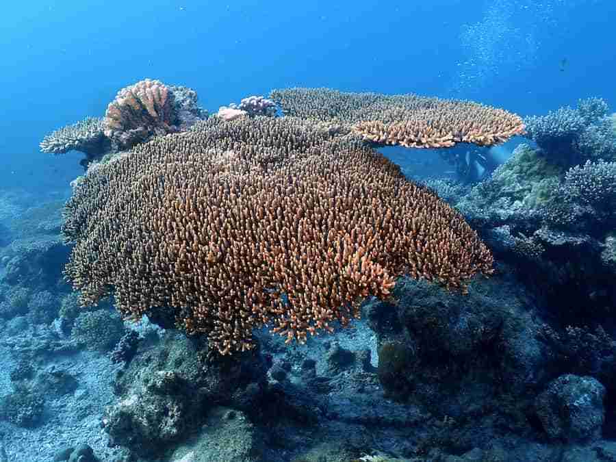
Frankly, almost nowhere else on this coast has been left alone. Gabr el Bint sits seven and a half kilometres south of the Caves, and because no road reaches the bay, tourism has barely touched it. The coral is essentially undamaged.
Then there is the setting. Namely, Gebel Umm Isheirat rises past a thousand metres directly behind the bay, so the landscape above water is as severe as the wall below it. Consequently the day feels like an expedition rather than a dive.
Meanwhile the reef draws pelagic species in from the blue alongside the usual residents, which is unusual this close to shore. That combination is the whole argument for making the journey.
What you are diving
- Firstly a hard coral buttress pushing a dozen metres out from the coast
- Then the wall itself, dropping away into open blue
- Also the gorgonian shelf at 20 m, with overhangs and small caves
- Then the reef below it, running on down to thirty metres
- Meanwhile the double line of gorgonians that marks the turn
- Besides those, the sandy valley at 10 m on the way home
- Finally two separate routes, north and south, from one entry
The remoteness is the point, and the risk. There is no dive centre, no shade, no water and no phone signal worth relying on at Gabr el Bint. Everything you need arrives with you and leaves with you.
How the camel route works. Namely the coastal track stops about one and a half kilometres past the Caves. Bedouins there hire out camels, load the equipment, and walk it in with you.
Reaching Gabr el Bint
Firstly the honest version: there is no driving to Gabr el Bint. The coastal track ends past the Caves, and the last stretch is done on foot, on a camel or on a boat.
Then the choice. By boat from Dahab the crossing runs about an hour each way, which is the easy option and the one most centres sell. By camel it is roughly ninety minutes, which is slower, hotter and considerably more memorable.
Consequently this is a full day rather than a morning, and it does not combine with anything else. Nobody dives Gabr el Bint and the Blue Hole on the same day.
Good to know before you go
- Firstly the boat: about an hour each way from Dahab
- Then the depth limit, thirty metres, agreed before anyone gets wet
- Then the camel route: roughly ninety minutes from the end of the track
- Also park fees, which apply inside the protected area
- Meanwhile water, shade and food, because there is nothing at the site
- Besides those, spares and a save-a-dive kit, since nothing is fixable there
- Finally your rubbish, all of which leaves with you
Check the sea, not the sky. A calm forecast at Dahab does not guarantee a workable entry down here. If the boat crew hesitates, the day turns around, and that call is theirs.
Two dives from one entry at Gabr el Bint
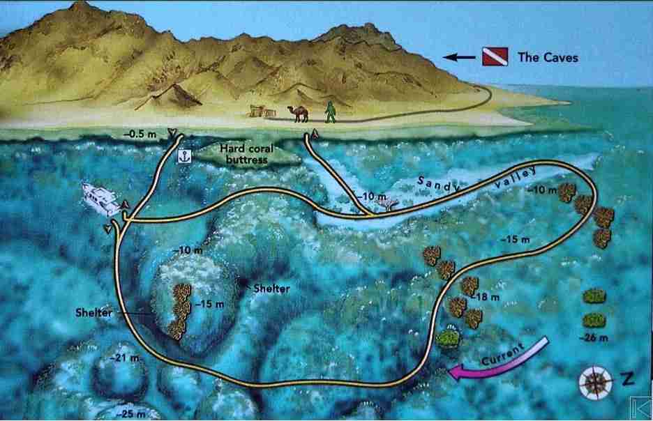
A large hard coral buttress pushes out of the coast for a dozen metres, and it defines the whole site. Two separate routes run from it, one heading north and one heading south. Divers who know Gabr el Bint agree the northern route is the better of the two.
North of the buttress — the wall
Firstly, this is the definitive Gabr el Bint dive. Enter south of the coral buttress and drop onto the gorgonian shelf at twenty metres, where the overhangs and shelters begin. Below that the reef keeps going to thirty, which is the hard floor for this route rather than an invitation. Then head north with the madrepore wall on your right shoulder, watching the blue as you go. After a double line of gorgonians, ascend to ten metres and cross the sandy valley southwards to close the loop.
Watch for
- Firstly the wall itself, hung with table corals, alcyonarians and black coral
- Then the shelters and small caves worked into its face
- Also the blue on your left, where trevallies and snappers pass through
- Finally the double gorgonian line, which is the signal to turn shallow
Keep gas for the valley. The sandy shallows at ten metres are the richest part of the return, and divers who race back along the wall arrive with nothing left to spend on them.
South of the buttress
Meanwhile the southern route is the quieter half, and it makes an excellent second dive once the northern wall has been done. The same coral structure continues, the profile is gentler, and the shallow coral heads suit a camera better than the drop-off does.
Watch for
- Firstly the shallower profile, which buys a longer bottom time
- Then the sand patches, where bluespotted rays sit half-buried
- Also the coral heads, dense enough to reward slow searching
- Finally the surface interval, since this is usually dive two of two
The northern route in order
Marine life at Gabr el Bint
Above all, the mix here is what makes the journey worth it. A shore-side wall that pulls open-water species in from the blue is rare anywhere, and rarer still on a reef this undamaged.
Along the wall
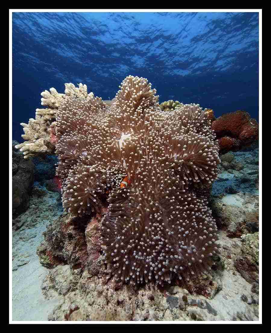
Namely clouds of red anthias, parrotfish, anemonefish in their hosts and common lionfish (Pterois miles) working the coral face.
Out in the blue
Also shoals of trevallies, snappers and emperor fish passing by, which is unusual for a wall this close to shore.
Turtles
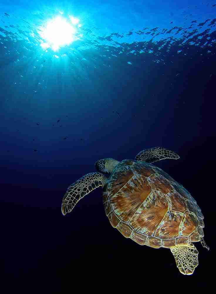
Meanwhile a hawksbill (Eretmochelys imbricata) turns up often enough to be worth watching for near the shelters.
On the sand
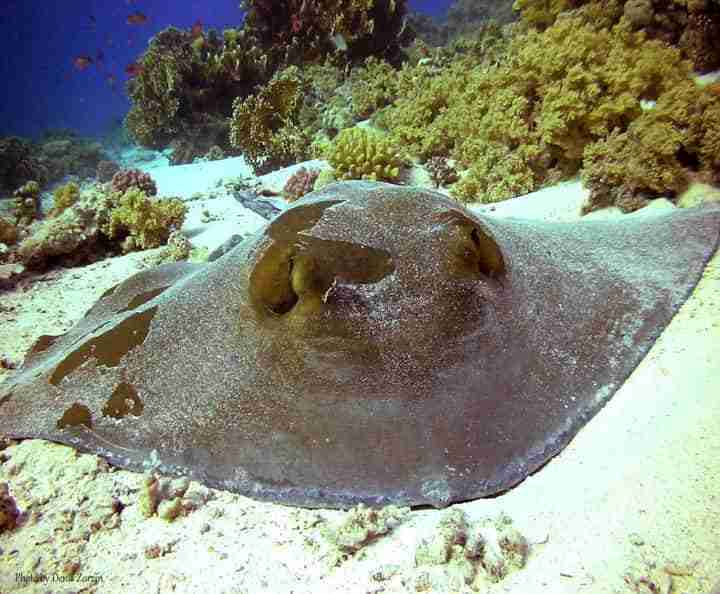
Certainly bluespotted stingrays (Taeniura lymma) half-buried across the valley, and the far larger blotched fantail ray (Taeniurops meyeni) out on the open sand.
In the shallows
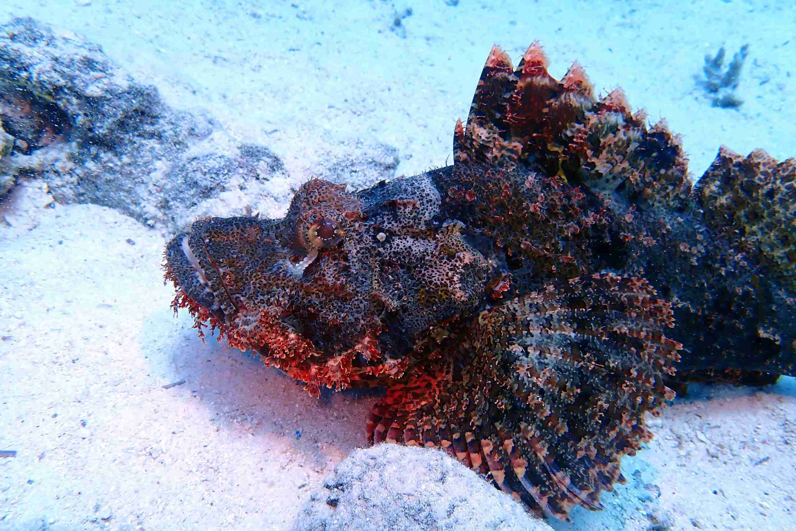
Notably triggerfish, crocodilefish and scorpionfish, which are effectively guaranteed on the return leg.
Near the surface
Finally cornetfish (Fistularia commersoni) hanging just under the surface, hunting on the way back.
Conditions and access at Gabr el Bint
Water
- Firstly visibility, generally excellent given how little traffic there is
- Then temperature: 21 to 22°C in winter, 25 to 27°C in summer
- Also current, usually mild but stronger off the buttress itself
- Finally exposure: a 5 mm suit works, and a hood helps in winter
Getting in
- Firstly by boat from Dahab, roughly an hour each way
- Then by camel from where the coastal track ends past the Caves
- Also on foot, for anyone willing to carry their own kit that far
- Finally never by car, because no road reaches the bay at all
Practical notes
- Firstly treat the Gabr el Bint dive as a full day, not a morning
- Then go with a guide who has run the northern route before
- Also carry water, shade and food for everyone in the group
- Meanwhile bring a save-a-dive kit, since nothing is repairable on site
- Consequently plan gas conservatively: there is no second cylinder waiting
- Carry a surface marker and a whistle for the boat pickup
- Also budget for park fees inside the protected area
- Finally take every piece of rubbish back out with you
Level. Open water with a guide is enough for the diving itself, since the route bottoms out at thirty metres. Remoteness rather than depth is what makes this site demanding.
Planning a day at Gabr el Bint
Generally the day runs as two dives with a long surface interval between them, because there is nowhere to go and no reason to rush. Above all, the northern wall goes first while everyone is fresh.
Meanwhile the return journey is part of the plan rather than an afterthought. Whether you leave by boat or by camel, allow for it before the light goes.
Useful links
- Dahab dive sites — the whole coast, north and south, in one guide.
- Ras Abu Galum to the Caves — the sites either side of this one.
- The Canyon — the deep fissure and its glassfish cave.
- The Blue Hole — the 120 m sinkhole, the Bells and the Arch.
- Dahab shore diving — entries, kit and how a shore day actually runs.
- Safety standards and emergency care — briefings, oxygen and chamber contacts.
- Red Sea Liveaboard — safari routes and boats across the Egyptian Red Sea.
- Divers Alert Network (DAN) — insurance and emergency guidance.
Frequently asked questions
How do I get to Gabr el Bint?
Either by boat from Dahab in roughly an hour, or overland by camel from the point where the coastal track ends past the Caves.
Can I drive there?
No. The track stops about a kilometre and a half beyond the Caves, and the rest of the journey is on foot, camel or boat.
Which of the two dives is better?
North of the buttress, because its wall carries the fan corals, the small caves and most of the pelagic traffic.
How deep does the route go?
Thirty metres at its deepest, with the gorgonian shelf at twenty, then a slow ascent to ten for the sandy valley on the way back to the entry.
Is Gabr el Bint suitable for newer divers?
With a guide, yes, provided the sea is calm. Remoteness rather than depth is what makes this site demanding.
Are there facilities at the site?
None whatsoever. Therefore bring water, shade and food, and carry everything back out when you leave.
What are you waiting for?
Book your adventure
Tell us which experience you want to enjoy and leave the rest to us. If you have questions, or you are still choosing between routes, our team will talk it through with you before you commit to anything.
Inquiry